Lead the Way

Day Seven

Zion to Arches
Total Miles Hiked: 2.86 (37.56 overall)

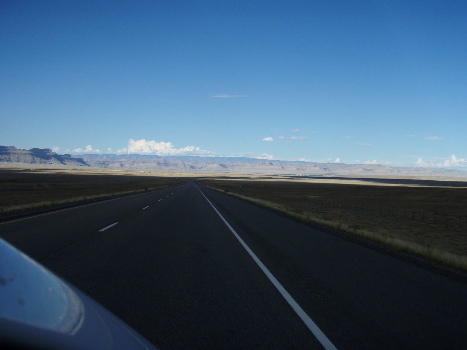
Another day on the road and once more the scenery is gorgeous. It’s also really enjoyable to take in while going the posted speed limit: 80 mph! We had a lot of state to cover. Of the five different National Parks that Utah has to offer, Zion and Arches are the furthest two apart. Going from Z to A is a fresh change of pace. We were really beginning to appreciate Utah, maybe it has a bit of a bad rap due to the wimpy beers and excess salt in lakes. However, things started to get a little shady. We were in need of lunchtime refreshments and were desperately searching for a rest stop. Now, normally, every so often there are places you can pull directly off the highway, have a tinkle, stretch your limbs, and suck up some caffeine. In Utah, they are a little confused. After changing highways, we spotted a telling blue sign for a rest stop and exited. We were already looking around for the parking lot area, however we were quickly instructed via subsequent signage to continue back towards the highway we’d just left. 3 miles. To a gas station? The sign in front proudly announced the rest stop, sponsored by Cheveron. It was a Cheveron. Oh, Utah. You got us.

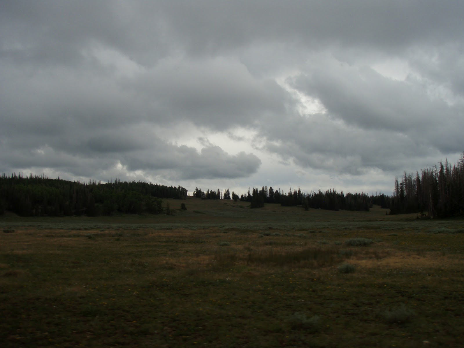
Ceder Breaks National Monument – meadow + forest
Photo by Rachel

Rachel’s Ramblings:
Have you ever gotten lost?  I’m guessing most people have.  However, I’m willing to bet that this happens to me more than the average bear.  I don’t know if it’s because I have a tragically bad sense of direction, or if I’m just too busy thinking about other things I have to do later, you know, after I achieve my destination.  In either case, I’ve been lost a fair number of times.  I’ve actually stopped calling it “being lost,” because that sounds too negative.  Now, whenever I find myself off the beaten path for some reason, I am “on an adventure.”

 
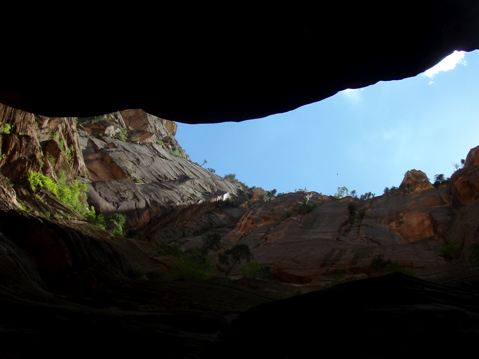
Leaving Zion – one last view of the sandstone walls.
Photo by Rachel

Lucky for Meridith, I took us on one such adventure when we were traveling from Zion to Arches.  But really, who wouldn’t want to pass back through Zion and see all those amazing sandstone formations one more time?  Basically, I got my easts and my wests a little confused and, BAM, our adventure had begun.  Lucky for me, after I gave Meridith many “I’m sorry”s accompanied by my best doe-eyed sad face she forgave me and saw the good in the situation.

 
Dixie National Forest – freshwater riparian area
Photo by Rachel

Our new path would take us through Dixie National Forest (http://www.fs.usda.gov/main/dixie/home)!  This is quite a large national forest (almost two million acres according to their website), and in the high elevations that we were driving through is dominated by aspen and various conifers.  This area is also dotted with many lakes.  Many of the lakes we passed were lovely with intact floodplains.  We admired the scenery of Dixie National Forest, about to be back on track when…the road was closed ahead, and we were redirected into Cedar Breaks National Monument.  At this point, we were just rolling with it. 

 
On the 70E in CO:  We crossed over those mountains 
and were uncomfortably close to the clouds.
Photo by Rachel

Cedar Breaks National Monument (http://www.nps.gov/cebr/index.htm) is an equally beautiful place to visit.  We drove through the high elevation forests, and saw some really stunning vistas.  I love high elevation meadows like the one pictured.  In front of all the meadows we passed were signs reading “Don’t Drive on Meadow.”  While that might seem like it would go without saying, it’s an excellent move on the part of Cedar Breaks to keep traffic off the meadows.  Subtle changes in elevation (like those resulting from foot traffic…or cars) can have major impacts on meadow ecosystems.  You might also notice in the right of the meadow pictures a stand of dead spruce trees.  We noticed this in Cedar Breaks and Dixie.  This is the result of the native spruce bark beetle which has reached epidemic proportions in recent years.  You can get the full story here (http://www.nps.gov/cebr/planyourvisit/upload/Why%20Are%20The%20Trees%20Dying%20Site%20Bulletin.pdf).  The current scientific theory is that a fungus is weakening tree’s natural defenses so trees that should fight off bark beetle infestation end up succumbing to the attack.  They are working on the problem, and increased scientific understanding is feeding directly into management action. 

 
After passing out of Cedar Breaks we were (finally) back on our original route and heading out of Utah and into Colorado!    

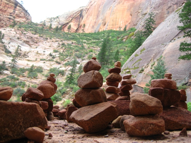
Getting lost while on a park trail is a major concern that you should keep in mind when hiking. Many parks have trails that are well developed and easy to follow. Other trails may be a bit more difficult to follow if they are a more natural terrain or if heavy weather is present. Some mountain trails experience white-outs that make things rather difficult to navigate. The current solution to this dilemma is about as simple as they get. You’ve probably already seen it and perhaps didn’t recognize the significance.

Rock cairns.

Or, rather, those silly little rock piles that you see everywhere.

They are actually handy little guides.

I’ve seen them lots to mark switch backs and overgrown trails.

Maybe if Zion had used them to mark the route to Arches we wouldn’t have gotten lost…I mean gone on a surprise adventure.


Question of the Day:
Have you ever been hiking a trail that used rock cairns? Did you know they were so helpful?

A Healthy Dose of Fear

Day Six

Zion National Park
Total Miles Hiked: 9 (34.7 overall)

A long rest was needed after the ups and downs of the previous day. The weather had cleared up enough for us to feel comfortable braving the Narrows. Even though we would be without the recommended walking stick. We took our sweet time puttering around South Campground in the morning. We realized we underpaid for the first two nights (access passes get 50% discount on campsite fees, not annual passes). We paid for one more night and the difference we owed, again careful to not upset any camping karma. We were nearly immediately rewarded when we noticed a Free Stuff Pile and there on top was a perfectly good, albeit slightly bent, walking stick! After another chat with the helpful Rangers Carolyn and Amanda, we were once more on the shuttle to the Temple of the Sinawava. 

Rachel’s Ramblings:

The Virgin River, and all rivers really, is a very powerful thing. 
As we rode the shuttle up to the trailhead, the soothing voice over the bus speakers told us about the many times the river had washed out the road causing evacuations and necessitating road repair.  Despite the many times this had happened, the voice assured us it would have happened a lot more if not for the work of the men of the Civilian Conservation Corps (the workers were segregated and no women ever enrolled).  Back in the 1930s and 40s these government workers came in and did hours of what was certainly physically taxing labor to secure the river banks.  This engineering of the river caused it to run straighter, faster, and kept water out of the historic flood plain and, thus, out of the road. 
Despite the good intentions of the CCC, all their hard work had unexpected consequences on the riparian ecosystem surrounding the Virgin River.  As our drive up to the trail head continued, the voice informed us that most of the cotton wood trees along the riparian strip next to the Virgin River were about the same age, and that is why we saw so many dead trees on the drive.  These trees were old.  You see, cotton wood trees need areas with near constant water sources to grow.  Even the fluffy seeds the trees release each year have to land on damp soil in order to germinate.  Due to the flood control measures enacted in the early 20th century, there are very few young cotton wood trees along this area of the river.
The shuttle audio didn’t go into detail, it was only a 30 minute drive after all, but this sort of change in riparian vegetation can have major impacts on ecosystems.  I’m not trying to bash the CCC.  It’s so easy to look at these sorts of situations with our modern eye and pass judgment.  However, I think Zion felt it important to share this story so that visitors could see how fragile these ecosystems really are.         
Still wide at the beginning of the trail.
Lots of sun.


We arrived. The paved beginning of the Riverside Walk was quite crowded with both hikers and crazy, in your face  canyon squirrels. Obviously one or two or a few hundred of the park visitors had disregarded the numerous postings about the importance of not feeding the wildlife. I saw small children walking right up to the rodents while their parents did nothing to protect them. No fear in these little guys. We continued along the river to the entrance.
 

We checked the skies once more before wading into the Virgin River for our adventure. Clear and sunny. No death via flash flood for at least a little while. Heading further up the river, the number of people thinned and the water deepened to our waists. Luckily, we are good little thinker-aheaders and had purchased dry bags before entering the park, so all of our day pack goodies were safe. Rachel, being the stream walking goddess that she is, decided I would benefit more from our karma walking stick. I completely did.

Our tiny sliver of sky for cloud watching.

The first three miles had periodic banks where we could escape the waters and tricky rocky bottoms for a nice stroll. Then back into the drink. After those initial three miles lay an additional two where we would be hiking in the river the entire time. This was where the danger zone really began. Clouds could roll in at any time upriver and release their torrents and we’d be subject to the results with little time to react. Only a tiny sliver of sky was viable above us, but we kept an eye on it at all times. Flash floods are a constant threat to hikers in the Narrows. If you can’t get to high ground, then your best bet it to try and wedge yourself behind rocks or cracks in the wall. 

Not the deepest we went!

We kept on. The water sometimes up to our waists. The rocks sometimes tricking our feet into thinking they were stable. Jerks. Even though I had the walking stick, I still took a few tumbles into the water while Rachel gracefully (well, more so than me) crossed back and forth over the river. I have to admit. The entire time we were hiking past the safe(er) zone I was looking for the best places to wedge myself (and Rachel) in case of a flash flood. It was much too lovely of a day to die in a furious barrage of water and tree detritus. 

Enthralled by the tadpolies.

Even with the fear of death, the walk proved to be a worthy endeavor. The sunlight tickled in every so often illuminating the impressive sandstone walls surrounding us. We hugged the walls every so often and were in awe of the colors, curves, and hidden treasures they offered. Some sections were shockingly smooth to the touch. We happened across pools teeming with aquatic wildlife that kept us enthralled for quite some time. Tadpoles darted about trying to eat up all the algal yummies so they could grow up to be big and strong with legs and everything. 

Rachel urged me further and further with the blatant lie of ‘let’s just check out what’s around the next bend’. There was even some veiled taunting, even it she may not admit it.

“Are you sure you don’t want to go as far as the old men?” RDW

I did want to go that far. Dang it. 

Our little bit of sunshine in the Narrows.

We kept on like brave explorers until we reached an area that we were informed would reach to nearly our chinny chin chins.

We looked at each other an a glimmer of understanding passed between us. We were brave, strong, adventurous women. We could handle anything.

And thus, we turned and headed back to the trail head. Even adventurous women need to know when to call it a day.

It ended up being a very solid decision, as we felt the first few drops of rain as we neared the area with the embankments. Once higher ground was within our reach, we both admittedly felt a surge of relief. There wasn’t a flash flood that day, but we were happy that we would’ve been safe had it been otherwise.

We emerged from the water once more victorious in our hike. The masses of people returned, as did the canyon squirrels. They would benefit from exhibiting the same amount of caution and fear as we had on our journey.

Question of the Day:
Have you even gone through with something, even though you were afraid? How did it turn out?

Everything the Light Touches is Yours

Day Five

Zion National Park
Established: 1909

Total Miles Hiked: 11.1 (25.7 overall)

Arriving at Zion NP the afternoon before had been a breathtaking event. Chelsea had warned us of its beauty, but the canyon is truly a sight you need to behold with your own eyes to appreciate. We wound down the mountain from the Southeast entrance, taking in as many views as possible without driving straight off the road. We passed through a tunnel and held our breath like good adventurers are supposed to do. We attempted to do the same at the next tunnel, but when we nearly passed out we decided it was best to cut our losses. For your future endevors, know that a 1.1 mile long tunnel is not the best place for the breath holding game. We managed to snag one of the few remaining First Come First Serve campsites (South Campground), checked out the nearby Visitor’s Center for our customary swag, and settled down with a hot dinner courtesy of my new backpacking stove. Then off to bed for another night in the tent.

Ranger Carolyn had warned us the previous day against hiking the Narrows due to a high chance of flash floods (we later learned that there indeed had been a flood on this day). She could tell we were pretty extreme ladies and recommended the Observation Point hike. This 8 mile hiked gained 2,148 feet to a viewpoint of Zion Canyon.

We were up and scurrying around the campsite before the sun peeked over the canyon walls. With a hot breakfast in our bellies, we gathered the supplies we’d need to fill our day packs. Snacks. Lots of water. First Aid Kit. Rain gear. Hats. Sunscreen. Headlamps. Multi-tool. Binoculars. Phones (in a plastic baggie). Cameras. Maps. Rain.

Rain?

We might have been ready to head out on our hike, but apparently nature wasn’t ready for us. We managed to stow our packs in the car, grab our letter writing box and hide in the tent while we waited out the rain.

A few postcards later, the rains let up and we quickly grabbed our packs and headed towards the visitor center before the sky changed its mind. Zion NP is uniquely in that it is primarily car-free park. We were able to leave our car at the campsite and walk a short jaunt to the nearby shuttle stop, where we immediately hopped on a shuttle. The ride was accented by an audio tour that points out major formations along the route in addition to detailing each stop. We rode our shuttle to the very top to catch the whole speal before heading back to our desired stop at Weeping Rock.

Hiking a narrow part of the trail.

After taking in a few informational signs, we were hiking and ascending towards Observation Point. We hike and climb. We climb and hike. We sweat and walk. We later agreed that had someone pointed out to us the ending location of our hike it would have been much more daunting. However, since we were blissfully unaware of the realities of our situation, the day went by quickly. We cheerfully greet people as they pass us. The normal hiking pleasantries, “Hey there, How’s it going?, See ya at the top, Holy crap, sir, is it much further?”. We enjoy talking to strangers. Most smiled and replied in kind.

It must be noted that every single stretch of this trail offered a wonderful view. We twisted in and out of different areas along the canyon walls. Sometime overlooking the Virgin River. Sometimes in narrow canyons. Sometimes with a view of pine trees. We took a birage of photos along the way, each time completely certain that the image captured couldn’t possibly be topped by another.

When we were thinking that we simply couldn’t go on much further, a lovely couple encouraged us with the reassurancet that we were only a few switchbacks from the top and then the trail would level out among the trees. We scrambled to the top and bathed in the shade of the Ponderosa Pines. Only a tiny bit further.

Hol-lee-crap.

View from the top

Now that’s a view. Even with clouds rolling in with some light rain on the far side of the canyon, this was still a spectacular vantage point overlooking Zion Canyon. The other hikers seemed just as pleased with the visual reward and lounged around, looking victorious. We were quickly welcomed into the elite ranks of successful summiteers. People are much more willing to chat with you when they are rested and enjoying the fruits of their labors. We took photos for other groups and they returned the favor for us.

I believe everyone would have been content to stay at the top of the canyon wall for the better portion of the afternoon. The clouds were creeping closer, and even though we were on the highest of high ground, we still felt the need to get back to our campsite. Bidding farwell and exchanging some campsite numbers with our new friends, we scampered down the trail much faster than the climb.

Happy faces at the top!

Safe and sound at the campsite, we once more began to forage. We were quite proud of our afternoon feat and felt deserving of an appropriately delicious treat. Before leaving for our journey, we’d stocked up on food and snacks, but one stood above the rest.

M&Ms.

They are the perfect candy. My favorite. I love eating them one color at a time. Letting them sit in my mouth until the candy coating melts (in the rightful place) them enjoying the chocolately center. Rattling the bag to make sure I’ve captured all the yellow ones before moving on to green.

We pull the unopened bag from our cooler. A fresh chill treat. I pull back the plastic tab to reveal the resealable zipper. XXL 56 ounce bags don’t mess around. I pull open the bag.

Now there is really only one reason I would go through the trouble of taking you through this giant lead up. Something bad has happened. Something tragic. A disaster of fierce proportions.

The bag had leaked.

Only a wet, brown desicration remained.

You can imagine my heartbreaking disappointment. My new favorite candy is now goldfish crackers. That is all I have to say about that.

I decided to make a glorious dinner to raise our spirits and set off into town in search of an onion. So many grand meals start with an onion. I decided on the camping stove version of the meal Chelsea had prepared for us. When I got back to good ol’ campsite 34 I was greeted by Rachel and two of our new friends from Observarion point. B and Br had decided to take us up on our dinner enticements and came bearing gifts of cheese, ramen, and a slackline. My dinner didn’t call for their provided ingredients, but Rachel’s enthusiasm over the slackline was immense. She’s now hooked and wants her own to perfect her skills.

After enjoying some after dinner refreshments, we chatted, we wandered about, we discussed the finer points of being a trail creeper (hint: it involved popping out from behind bushes and aggressively inquiring whether the unsuspecting hiker is a part of a very popular social networking site). The night wound down, as did we, and the first few stars began to visualize. Rachel gets excited if there are more than 4 stars out and tried to point out what she could. Br somehow manage to manifest a purple laser pointer that could be used to point out stars. But it was not quite dark enough. Our new friends eventually had to return to their own campsite, but gifted the laser pointer to us (they had two) so that Rachel could fulfill her new found desire to point at things in the sky. We will have to pass it on eventually and keep the camping karma going by meeting more friends and bestowing something of ours onto them.

Zion friends, if B managed to remember the website and you come check out our blog, shoot us an email with your details at alwaysscientist@gmail.com. If you include your addresses we’ll send you postcards!

Questions of the Day:
Have you ever made friends when talking to strangers on an adventure?